GNSS station
The Laboratory of Geodesy and Surveying of the University of West Attica (UNIWA) has established and operate permanent GNSS stations. At present, the Laboratory has two permanent stations under control, one at the University Campus 1 (Aegaleo) and one at Pogoniani village of Ioannina.
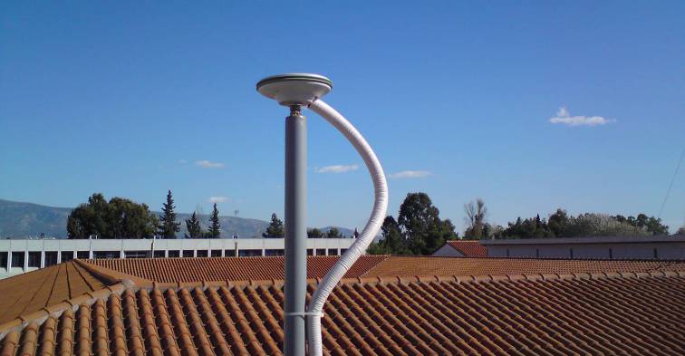
Permanent GNSS station of the University Campus 1 (TEIA)
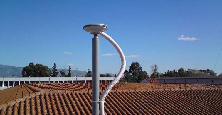
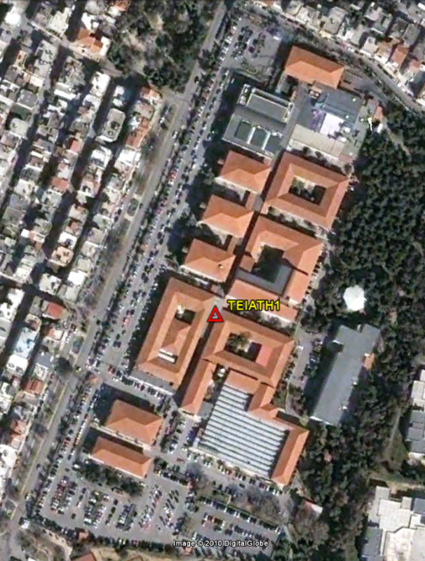
The Laboratory has established since 2010 a permanent GNSS (Global Navigation Satellite System) station. The station named TEIATH1 (TEIA – 4 letter abbreviation) is established at the building K10 of the School of Engineering at University Campus 1. The station collects data from GPS (Global Positioning System) and will soon support GLONASS, GALILEO and BEIDOU satellite systems. The receiver of the permanent GNSS station TEIA is a LEICA GRX1200PRO and the antenna used is the AX1202 GG Pillar.
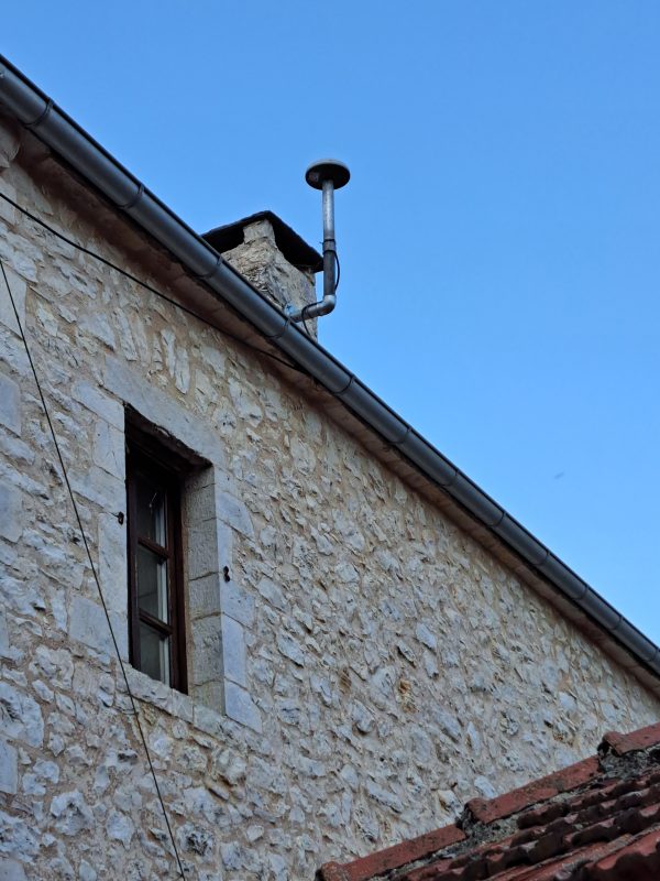
Permanent GNSS station at Pogoniani Ioanninon (POGN)
During July 2023 the Laboratory of Geodesy and Surveying has established a new permanent GNSS station at a community building in Pogoniani Ioanninon. The new station is named POGN (4 letter abbreviation). The new station collects GPS, GLONASS, GALILEO and BEIDOU satellite data. The receiver of the permanent GNSS station POGN is a LEICA GNSS1200+, while the antenna used is the LEICA AR10 antenna.

The installation and operation of permanent GNSS stations has been a constantly evolving and strongly growing activity in most countries in recent years. The operation of a permanent GNSS station is a key tool in the modern field of work and research of all those involved in the Geosciences. Permanent GNSS stations are the source of 24-hour data and provide solutions in many geodetic – surveying problems. Also, they can be part of a wider network of permanent stations increasing the possibilities of applications in Geosciences. The networks of permanent GNSS stations can be used in applications as:
- Geodesy (earth rotation parameters, national geodetic networks)
- Geodynamics (tectonic plates motion)
- Geology (location of geological phenomena)
- Seismology (estimation of fault dynamic characteristics)
- Surveying (network adjustments and surveying maps)
The permanent GNSS station is fully functional and ready to provide GNSS data (receiver independent format) using internet connection. The recording rate is set to 30 seconds while the elevation mask is chosen to be 10°. The data are recorded into daily files.
The data are freely available to the University community under the url:
http://gpsstation.labgeo.uniwa.gr/
In addition, only for research purposes, 1 sec data are available. For the 1 sec data and the coordinates of the permanent station in ITRF please contact Prof. V. D. Andritsanos (vdandrit@uniwa.gr)
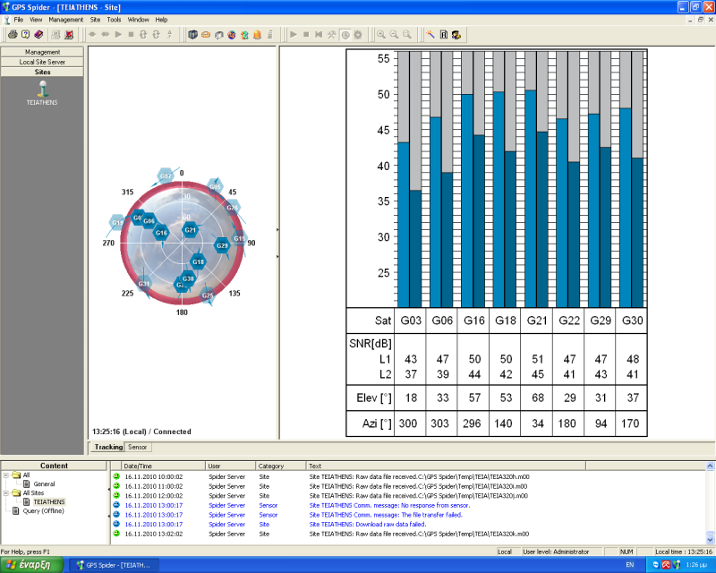
The monitoring of TEIA permanent GNSS station is done via the internet using appropriate software installed both in the receiver’s internal memory and on the webserver located in the Laboratory of Geodesy and Surveying.
|
TEIA permanent GNSS station control software |
Satellite availability (16/11/2010 – 14:27) |